New rules are now in place for marine protection areas in the Bay of Islands and Mimiwhangata.
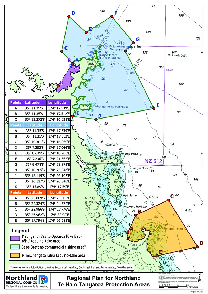
Please refer to the map below for details:
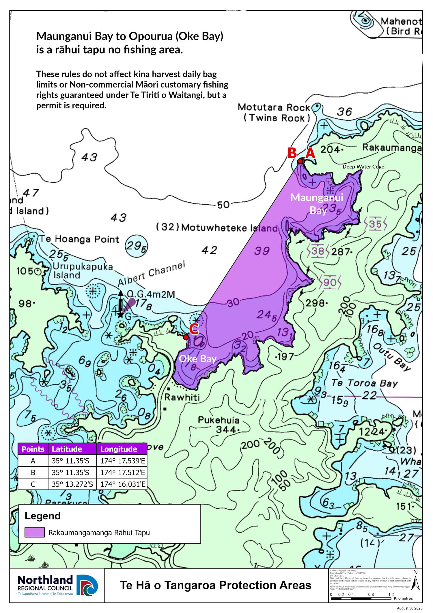
- The purple area Maunganui Bay to Opourua (Oke Bay) is a rāhui tapu no fishing area.
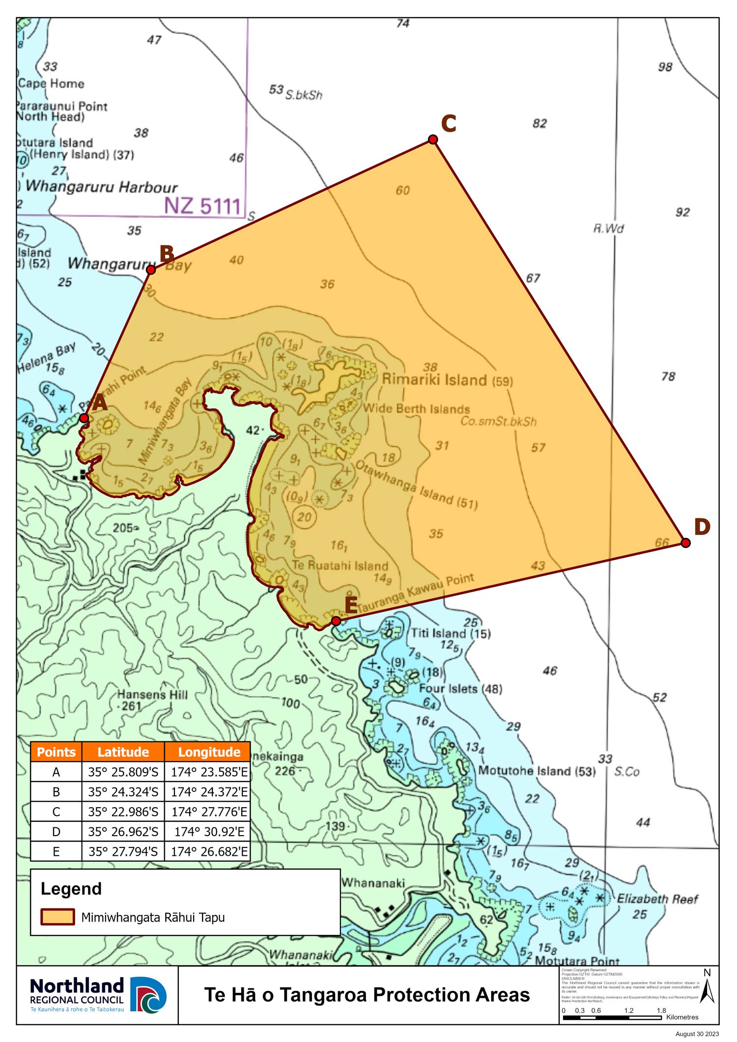
- The orange area Mimiwhangata is a rāhui tapu no fishing area.
- The light blue area relates only to commercial fishing - bulk harvesting of fish using specific seining and trawling methods is prohibited to a depth of 100 metres (Ngā Au o Morunga Mai Rakaumangamanga Protection Area).
- These rules do not affect kina harvest daily bag limits or Non-commercial Māori customary fishing rights guaranteed under Te Tiriti o Waitangi, but a permit is required.
Download a high-res map of the boundaries here
Full details here: https://www.nrc.govt.nz/environment/coast/marine-protection-areas/